


Franklin Precinct, Butler County, Nebraska
About
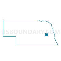
Outline

Summary
| Unique Area Identifier | 612510 |
| Name | Franklin Precinct |
| County | Butler County |
| State | Nebraska |
| Area (square miles) | 34.08 |
| Land Area (square miles) | 33.90 |
| Water Area (square miles) | 0.18 |
| % of Land Area | 99.48 |
| % of Water Area | 0.52 |
| Latitude of the Internal Point | 41.26099390 |
| Longtitude of the Internal Point | -97.08485600 |
Maps


Graphs
Select a template below for downloading or customizing gragh for Franklin Precinct, Butler County, Nebraska


Neighbors
Neighoring Voting District (by Name) Neighboring Voting District on the Map
- Bone Creek Precinct, Butler County, NE
- Center Precinct, Butler County, NE
- David City Ward 1, Butler County, NE
- David City Ward 2, Butler County, NE
- David City Ward 3, Butler County, NE
- Linwood Precinct, Butler County, NE
- Oak Creek Precinct, Butler County, NE
- Olive Precinct, Butler County, NE
- Savannah Precinct, Butler County, NE
- Skull Creek Precinct, Butler County, NE
- Union Precinct, Butler County, NE
Top 10 Neighboring County Subdivision (by Population) Neighboring County Subdivision on the Map
- David City city, Butler County, NE (2,906)
- Savannah township, Butler County, NE (624)
- Oak Creek township, Butler County, NE (500)
- Bone Creek township, Butler County, NE (358)
- Skull Creek township, Butler County, NE (271)
- Linwood township, Butler County, NE (243)
- Olive township, Butler County, NE (237)
- Franklin township, Butler County, NE (232)
- Union township, Butler County, NE (211)
- Center township, Butler County, NE (200)
Top 10 Neighboring Place (by Population) Neighboring Place on the Map
Top 10 Neighboring Unified School District (by Population) Neighboring Unified School District on the Map
- Schuyler Community Schools, NE (8,316)
- David City Public Schools, NE (5,676)
- East Butler Public Schools, NE (1,902)